


20180814

Frings
User

Length
15.3 km

Max alt
2305 m

Uphill gradient
442 m
Km-Effort
21 km

Min alt
1909 m

Downhill gradient
442 m
Boucle
Yes
Creation date :
2019-01-15 14:40:44.697
Updated on :
2019-01-15 14:40:44.697
6h40
Difficulty : Unknown

FREE GPS app for hiking
 SityTrail
IGN / Geographical institutes
SityTrail Plus
The world is yours!
About
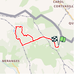
Trail Other activity of 15.3 km to be discovered at Catalonia, Girona, Guils de Cerdanya. This trail is proposed by Frings.
Positioning
Country:
Spain
Region :
Catalonia
Department/Province :
Girona
Municipality :
Guils de Cerdanya
Location:
Unknown
Start:(Dec)
Start:(UTM)
404996 ; 4701438 (31T) N.
Comments